
D.8 WHAT THE EYE CANNOT SEE: GROUND PENETRATING RADAR
In order to recover and showcase the Punta Begoña Galleries, we all share the overriding concern for preserving the building’s original features, which is why the use of non-destructive techniques for its diagnosis and surveying is essential when addressing different problem areas.
Geophysics uses non-destructive techniques such as ground penetrating radar (GPR) to identify materials that our eyes cannot see. Sweeping with several radar antennae generates continuous profiles that are referred to as radargrams. These images are processed with the “false-colour” method in order to differentiate between the different features under study, regarding both the cliff itself and the building’s structure.
We have therefore used GPR to identify natural structures in the rock mass on the cliff. The combination of this technique and hydrogeological surveys has enabled us to map the flow of groundwater; this is an extremely important aspect, as water is one of the main agents affecting the building.
As regards the building’s structure, we are using different antennae to determine both the positioning and the thickness of the reinforcing in the concrete. In the case of the terrace we are on, we have identified the internal relationships between the structural features, pillars and beams and the upper layer of concrete, and the contact between the latter and the cliffside.
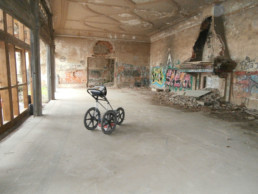
Ground penetrating radar equipment in the hall, 2016. Source: Project for showcasing the Punta Begoña Galleries
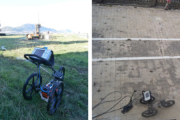
GPR equipment in the garden (left) and on the south-west terrace (right), 2016. Source: Project for showcasing the Punta Begoña Galleries
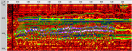
Radargram recorded in the rotunda on the south-west terrace, 2016. Source: Project for showcasing the Punta Begoña Galleries
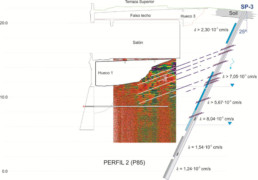
Explanatory side-view schema of the hall produced by a piezometric survey and water flow results, 2016. Source: Project for showcasing the Punta Begoña Galleries