
B.9 FLAT LAND AND CLIFFS
The cliff into which the Punta Begoña Galleries were built ranges from 70 to 100 metres in height, and the land at its top and bottom is flat. You are now standing on the cliff top, and below you is Ereaga Beach. These flat areas are known as tidal plains.
The sheer cliff face marks the limit of erosion by the sea. Tidal plains form in the area between high and low tides due to the erosive action of the waves, which carry away sediment.
The flat area below you is the current tidal plain at sea level. At low tide you can see the almost-vertical strata protruding from the sand, especially at the ends of the beach and in the area behind the lighthouse.
The cliff-top land is known as a “paleo-tidal plain”, as it now stands well above the tide level. It was formed between glaciation periods in the Quaternary Era, and subsequently pushed up by major land shifts.
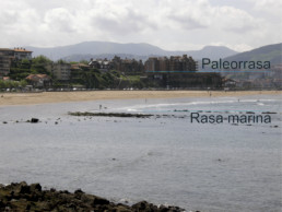
Photo of the galleries seen from the Old Port, showing the strata protruding from the sand on the current tidal plan and the level of the paleo-tidal plan, 2017. Source: Project for showcasing the Punta Begoña Galleries
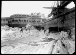
The Punta Begoña Galleries seen from Ereaga Beach, with the strata visible at low tide (undated). Source: Archives of the Bilbao Port Authority
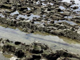
Detail of the rocky strata of the current tidal plain at low tide, 2017. Source: Project for showcasing the Punta Begoña Galleries